Since Indie is doing the between war year by year, and one part I love about history is local history. I was wondering for a thread if people would like to submit a paragraph or 2 about what was going on locally were you live.
3 Likes
What an awesome idea for a thread!
I’ll start with where I live, Townsville in tropical North Queensland. Here’s where it is for the geographically challenged.

Townsville was somewhat unexpectedly thrust into WW2 with the bombing of Pearl Harbor and the subsequent attack on Darwin. The unofficial capital of North Queensland, Townsville at the time had a population of around 20,000. It had grown up around a port which serviced the growing sugar cane and gold mining industries in the region and was an important regional centre. With the threat of invasion looming, the whole of the Top End of Australia was suddenly under threat. With a scare population and an equally scarce infrastructure, these must have seemed like desperate times, especially when the Brisbane Line was being discussed as government policy. Townsville was also subject to 3 small bombing raids by the Japanese during July 1942. Many children were evacuated “down South” because of fears of Japanese attacks.

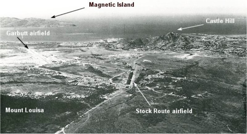
As the war in the South Pacific got going though, things rapidly changed and soon Townsville became a major staging point for operations against the Japanese in Indonesia and New Guinea. The town became the largest airbase in the Southern Hemisphere, with airfields constructed all over town and out towards Chartres Towers, further inland.
Some can be seen on this image…
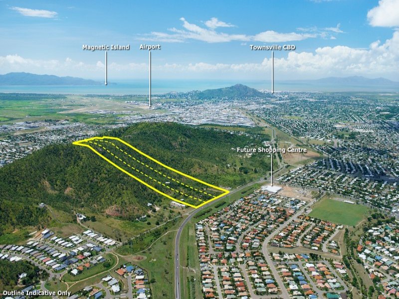
…which can be compared to a similar view today showing the amount of post war development in the town.
Military personal flooded into town, creating a serious strain on the town’s infrastructure, and water in particular.

In this image, American landing craft can be seen unloading troops at the Kissing Point barracks on the Strand. Here’s a view of the same area today, albeit from a different angle.

Early in 1943, Townsville harbour was also “attacked” by a party from Z special unit as part of a training mission. The raid included Lt. Bob Paige who later went on the Jaywick and Rimau raids on Singapore.
Gradually, the war moved on and left Townsville behind but a number of relics of the war can still be seen today. Townsville remains an army town, and has a brigade of the Australian army based here. Here are some of them marching along the Strand on ANZAC day.

A number of old gun batteries can be seen overlooking the approaches to Townsville harbour, both at Cape Pallarenda and on Magnetic Island, just across the bay.

Townsville’s airport, in common with many regional airports in North Queensland was originally an airstrip constructed for WW2, and can be seen marked on the photo above as Garbutt airstrip.
The old 19th century gun battery and barracks on Kissing Point can be toured today and the Fort has a nice memorial which commemorates, among other things, the part that the region played in the battle of the Coral Sea.
7 Likes
Ok here mine
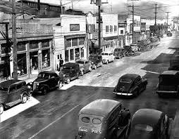
I grew up in San Pedro California, part of the city of Los Angeles and home to the port of Los Angeles.
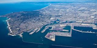
The port was built in 1903 and today is one of the busiest container ports in the world. The location of the port was a major battle in the city the railroads wanted the port in Santa Monica closer to their rail yards, but the city wanted the port in San Pedro were their were already landings and was more protected. Well the city fathers won out and the port was built in San Pedro.
from History | About | Port of Los Angeles
“This is the story of the Port of Los Angeles an extraordinary monument to the power of human energy, vision and selflessness. Indeed, the history of its growth and development incorporates so many of the elements of high drama that it reads like the inspirational fiction of turn-of-the-century America. It is, in fact, a rich and pungent slice of authentic frontier Americana in its purest form…” From Wilderness to World Port, 1983.
Cabrillo’s Discovery
The first official documentation of the harbor was by Portuguese explorer Juan Rodriguez Cabrillo. On October 8, 1542, Cabrillo came across a marshland and natural harbor at the northwest end of San Pedro Bay and named the area Bahia de Los Fumas or “Bay of Smokes” after the smoke that rose from the nearby hillside of Native American hunters. This fairly desolate area remained largely intact until 1769, when Spanish officials and missionaries set their sights on colonizing the U.S. West Coast. This led to the first commercial ventures in San Pedro in the mid-1800s. The rest, as they say, is history.
The harbor in San Pedro was used as a trading post by Spanish missionary monks from Mission San Gabriel Arcángel. The monks met ships at the water’s edge with provisions from Spain. The first American trading ship to call at San Pedro was the Lelia Bryd, in 1805. At that time, it was illegal to conduct business with any other country but Spain. Because of the distance and loose regulations, however, trade with other countries thrived. In 1822 an independent Mexican government lifted the Spanish restrictions on trade. That led to a surge of settlement and commercial ventures in San Pedro. By the time California joined in the Union, in 1848, business in San Pedro harbor was flourishing.
A host of politicians, businessmen and community visionaries are responsible for San Pedro Bay fulfilling its ultimate destiny of becoming the largest cargo gateway into North America. One such visionary was Phineas Banning, who founded Wilmington and was nicknamed the Father of Los Angeles Harbor. His entrepreneurialism and influence positioned the Port for future success as the maritime and trade center for a rapidly growing west coast city.
Another person to play an important role in the development of San Pedro Bay was Stephen M. White, also called the Savior of the Bay. White, a senator from California, stood up to big business and political forces, pushing through regulation that led Congress to declare San Pedro Bay as the official port for Los Angeles in 1897.
A Harbor is Born
The City of Los Angeles and the Harbor Area experienced unparalleled population growth in the early 20th century. City leaders recognized the Port’s growth opportunities and created the Board of Harbor Commissioners on December 9, 1907, thus marking the official founding of the Port of Los Angeles. The cities of San Pedro and Wilmington were annexed to the City of Los Angeles on August 28, 1909, making the Port of Los Angeles an official department of the City of Los Angeles.
Various industries began popping up in and around the Port in the early 1900s. Fishing, canneries, oil drilling and shipbuilding were major industries that generated jobs and commerce to Los Angeles and its growing population. Because of increased business activities at the Port, it was extremely important for city officials to focus on port infrastructure and future development.
By 1912, dredging and widening the main channel, and completing major sections of the federal breakwater, enabled the Port to accommodate larger vessels. These expansions proved effective once the Panama Canal opened in 1914, giving the Port of Los Angeles a unique strategic position for international trade and a clear advantage over northern West Coast ports as a destination point for east-to-west seaborne trade because of its proximity to the Panama Canal.
Wartime Efforts
The Port’s growth came to a standstill with the onset of World War II. The United States military commissioned the Port to conduct only war-time efforts, and the Port did so with diligence and success. Shipbuilding became the prime economic industry at the Port. Every boat repair and shipbuilding company assisted in the construction, conversion and repair of vessels for the war effort. San Pedro Bay shipyards collectively employed more than 90,000 workers and produced thousands of war-time vessels at record pace. After the victory of World War II, Port of Los Angeles officials again began focusing their attention to the continued expansion and development of the Port.
Post-War Growth
Up until the mid-20th century, the Port received cargo in crates, pallets, and small lots of varying sizes and shapes. Because of the lack of uniformity and security, unloading cargo was painstakingly slow and the frequency of damage, pilferage and loss of cargo was high. Providing a better solution, the containerized cargo revolution came to the Port in the late 1950s. Containers can easily be loaded, sealed and shipped on vessels, railroad cars, and trucks. Almost every manufactured product or its components are shipped in a container. Containerization is an important element of the innovations in logistics and security that propelled the Port of Los Angeles to critical national importance.
The Port Today
The Port of Los Angeles is the number one port by container volume and cargo value in the United States, handling an impressive 8.1 million TEUs (twenty-foot equivalent units) in calendar year 2015. As the leading gateway for trade between the U.S. and Asia, our port and supply chain partners provide outstanding cargo conveyance through modernized and “big-ship-ready” marine terminal facilities; the largest workforce of skilled longshore labor; warehouse and trans-loading centers to meet the needs of every shipper; the nation’s largest and newest drayage fleet; and rail connections that offer frequency and speed-to-market access to major freight hubs across the U.S.
The house I grew up in was adjacent to the navy’s main fuel depot for the war.
Fort MacArthur
http://www.ftmac.org/Fmhist.htm
On September 4, 1888 by Executive Order, the “Old Government Reservation” next to San Pedro Bay became property of the U.S. War Department. The property was originally a Spanish public landing and was reserved as “Government Land” when the United States gained control of Alta, California in 1848. In 1897 and 1910 additional tracts of land were added to the reservation in preparation for the construction of fortifications to guard the newly completed deep water harbor facilities of the port for the city of Los Angeles. The reservation was geographically divided into three parts: the Lower Reservation, Middle Reservation, and Upper Reservation.
In 1914 the property was named Fort MacArthur in honor of Lt. General Arthur MacArthur, Civil War Medal of Honor recipient and father of General Douglas MacArthur.
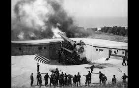
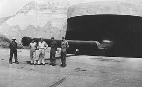
By 1919, construction had been completed on Fort MacArthur’s main armament of four 14-inch rifles mounted on ingenious “disappearing carriages” and eight 12-inch mortars mounted in massive concrete emplacements. These guns protected Los Angeles Harbor and had a range of up to fourteen miles. In addition to the big guns, electrically controlled mines were stored on the Lower Reservation for rapid deployment across the harbor entrance and were protected from enemy mine sweepers by four 3-inch rapid fire guns located on a sand spit off the end of what is today known as Terminal Island. By this time, the barracks and administration buildings on the Middle and Upper Reservations were also nearing completion.
After World War I, Fort MacArthur was regularly used for training and housing of California National Guard units, Citizens Military Training Corps, Army Reserve units, and the Civilian Conservation Corps. In 1920, four 3-inch anti-aircraft guns were added to the post’s arsenal and two 155mm guns were delivered in 1928. The biggest additions of firepower came to Fort MacArthur in 1925 and 1930 in the form of two 14-inch railway guns. Named Battery Irwin, these mobile guns could fire their 1400 lb. shells a distance of 27 miles and were eventually stored in special “breakaway” buildings.
After the attack on Pearl Harbor on December 7, 1941, additional 155mm and 3-inch anti-aircraft guns were added to the defenses of Los Angeles and a new fortification program hurried toward completion. This included the addition of Battery Paul D. Bunker located at White Point, and another unnamed 16-inch battery at Bolsa Chica beach that was never completed. These batteries were armed with two 16-inch barbette mount guns enclosed under large concrete portals. These were the largest and most powerful seacoast defense guns ever deployed by the United States and had a maximum range of about 26 miles.
To reinforce these batteries, three new 6-inch batteries were also built. Battery Harry J. Harrison at Bolsa Chica, Battery Barnes at Long Point, and Battery 241 located on the Upper Reservation. These guns were protected by 6-inch thick “teardrop” shaped metal shields, and looked like they would be more at home on a warship rather than on a hilltop overlooking the Pacific Ocean. Additionally, more than a dozen 90mm and 37mm guns were installed around the harbor area. As these new weapons were installed, the older guns were deactivated and shortly after 1945, all of Fort MacArthur’s big guns were cutup for scrap. Fort MacArthur continued to serve as an induction and separation center throughout the 1940s and 1950s

4 Likes
Really good thread idea!
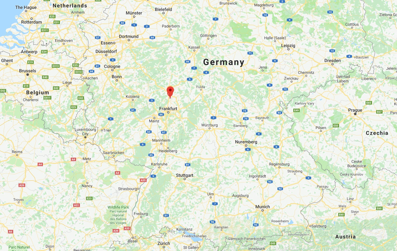
I live in Bad Nauheim in Hesse, and so probably nearly no one knows where it is so here it is on a map:
Before WW1 and also after that Nauheim, or as it was called after 1869 Bad Nauheim (Bad shows that it is a city for relaxing and has spa’s or health resort German word= Kurort, not sure how to translate it) and was only famous for being a resort to some famous people, under them was the old German chancellor Bismark, the Queen of Germany, the Queen of Austria-Hungary and Tsar Nikolas II. with his wife who was the sister of ruler of Hesse and many more like Albert Einstein, Erich Kästner, etc. . Also Franklin D. Roosevelt visited the city when he was 9 years old and even went to the public school there for a few months.
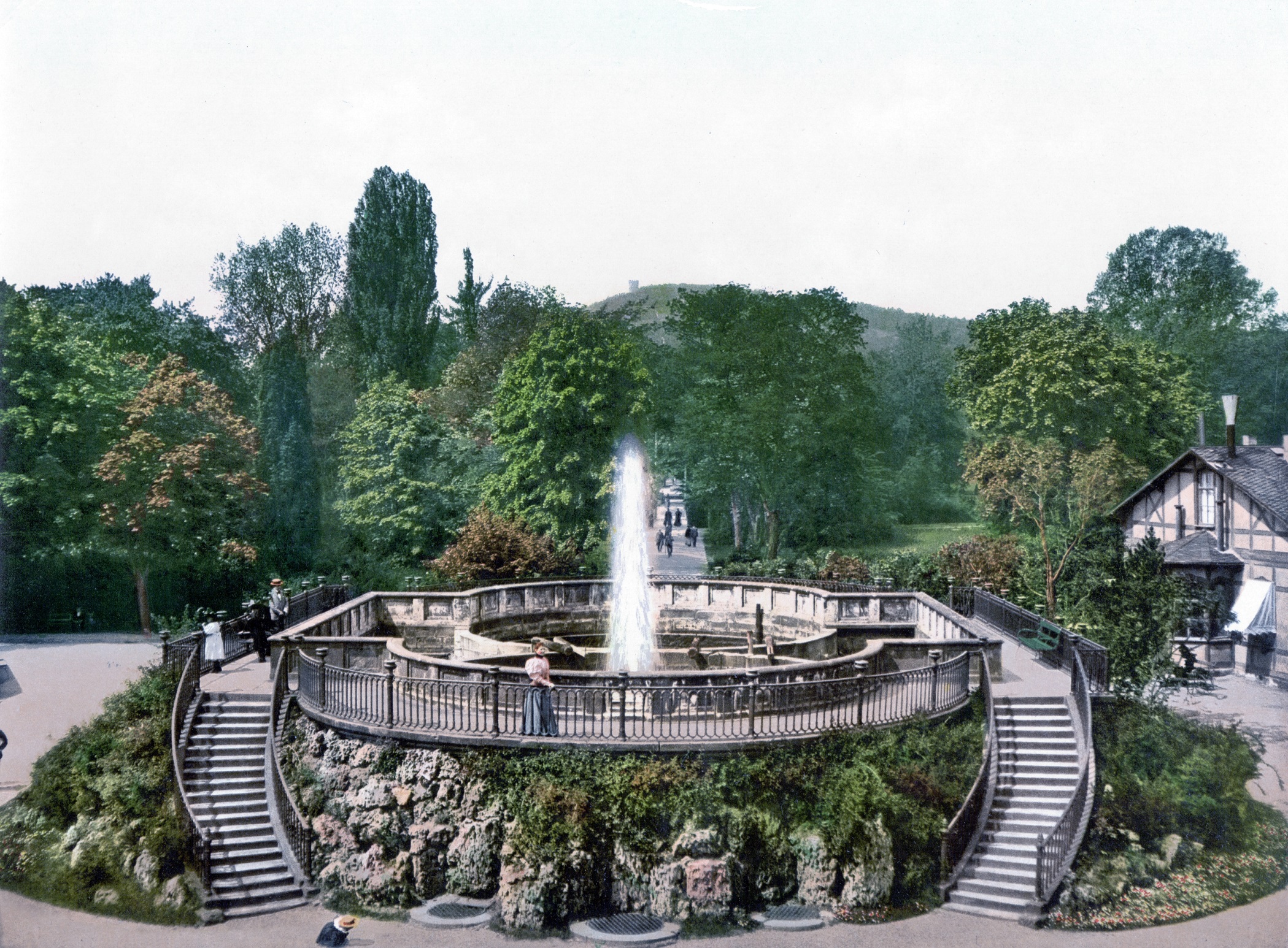
The health resort of Bad Nauheim, the so called Sprudelhof. (Translation= Fizzling court) It was famous for the water in it which should have healing properties and the may bathing houses around it.
In WW1 Bad Nauheim was used with the close city of Friedberg as a small railroad hub, but nothing else really happened here. After WW1 much of the Russian nobility flew to Bad Nauheim due to the closeness they had to the nobility in Hesse. Also many chess matches between the then best chess players were held in Bad Nauheim. Under them Michail Tal, Alexander Alexandrowitsch Aljechin and Paul Keres.
In 1929 the synagogue in Bad Nauheim was finished and was one of only three synagogues which weren’t destroyed in the Reichskristallnacht/Reichsprogromnacht/Night of broken glass in 1938.
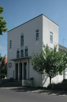
The same synagogue in 2007, it only went out of action between 1938-1945. It was built in the Bauhaus design, which is why it looks quite modern. This style of building was stopped 1933 by the Nazi regime because it has “communist influence”,the real reason is probably because the modern look which didn’t fit to the Nazi regime.
During the war the city was mostly used as a hospital city for wounded men and officers and for internment of prisoners, mostly officers who where imprisoned in the Hotels of the city which where under Wehrmacht control. Because of this the city wasn’t really bombed by the allies, only around 60 houses where destroyed before the allies liberated the city.
After the war the city was used by the Americans with the close city of Friedberg as a military base. The most famous soldier stationed there was Elvis Presley and because of that Bad Nauheim has many memorials for him like the house he lived in, some memorials and a annual Elvis Presley festival( I was never there).
Sorry if some of it was written badly and to small information over the city (I only really googled information in German and put them here in English and information over the interwar period is quite rare) but something is better than nothing.
6 Likes
To let you know I still live in the are just the next suburb over.
3 Likes
This an awesome thread idea - enjoying this!
2 Likes
Some more interesting history from my hometown during ww2.
from Japanese Memorial Terminal Island - SanPedro.com - San Pedro, California
In 1941, 3,000 first and second-generation Japanese made their homes in an area of Terminal Island known as East San Pedro. The Japanese Fishing Village was next to Fish Harbor. Most of the local residents worked in the fishing industry. Approximately 250 fishing boats were owned and/or operated by the residents. Most of the local people, not working on the boats, worked in the many fish canneries that were clustered together on Terminal Island. Because Terminal Island was somewhat isolated, the Terminal Islanders developed their own culture and even their own dialect. The people called their close community village “Furusato” which translated literally means “old village”. An English equivalent would be “hometown”, “native place” or “home sweet home”.
The village had a Fisherman’s Hall where the Japanese martial arts judo and kendo were taught, a Shinto Shrine, ethnic grocery stores, candy stores and billiard parlors. The Island children attended Walizer Elementary School and took the ferry to high school at San Pedro High School in San Pedro.
Soon after the attack on Pearl Harbor, the FBI rounded up all of the adult males and jailed them. On February 19, 1942, U.S. President Franklin D. Roosevelt signed Executive Order 9066. This Executive Order sent 120,000 Japanese Americans to internment camps . Of the ethic Japanese people forced into internment camps, about 62% were Nisei and Sansei ( 2nd and 3rd generation Japanese) and were American citizens by virtue of being born in the USA. The other 38% were Issei (Japanese immigrants) who were either naturalized American citizens or resident aliens.
In February of 1942, Terminal Island residents were the first Japanese Americans, on the West Coast, to be forcibly removed from their homes. They were forced to evacuate their homes within 48 hours and had to leave almost of all of their possessions behind including all of their fishing boats and fishing gear. Some were able to sell their furniture, fishing gear, boats and other items. Since the residents only had 48 hours to complete the transactions, they were often forced to sell at ridiculously low prices by greedy individuals taking advantage of the desperate situation.
All of the other residents of Terminal Island were also ordered to leave. The Daily Breeze newspaper dated February 27, 1942 had an article headlined “Whites and Japs Leave Terminal Island” which reported that the United States military had taken over Terminal Island and was patrolling the deserted streets.
The Japanese Village was stripped of anything of any value and flattened by bulldozers and completely destroyed . The fishing boats were either taken by the military, repossessed, stolen, or destroyed.
On January 2, 1945, the exclusion order was rescinded. The internees were released with $25.00 and a ticket home. They returned home to find nothing. Furusato was gone without a trace. The canneries were still operating and a few people went back to work there . The rest of the former residents were scattered. The former Japanese villagers were worried the memory, culture and history of Furusato would be lost forever. They stayed in touch with each other and tried to keep the memories alive.
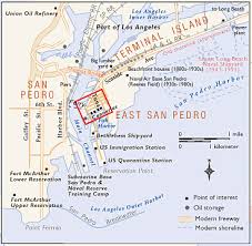
Map and photo of Japanese village
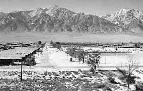
photo of Manzanar relocation camp
4 Likes
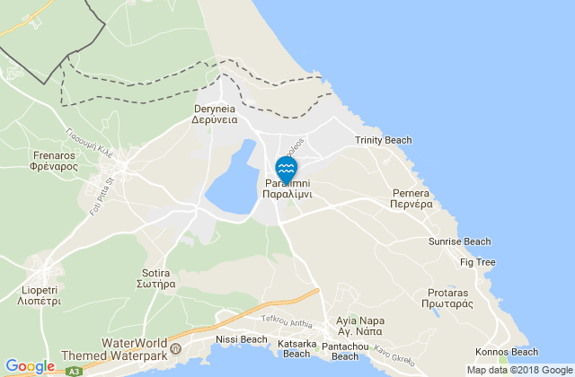
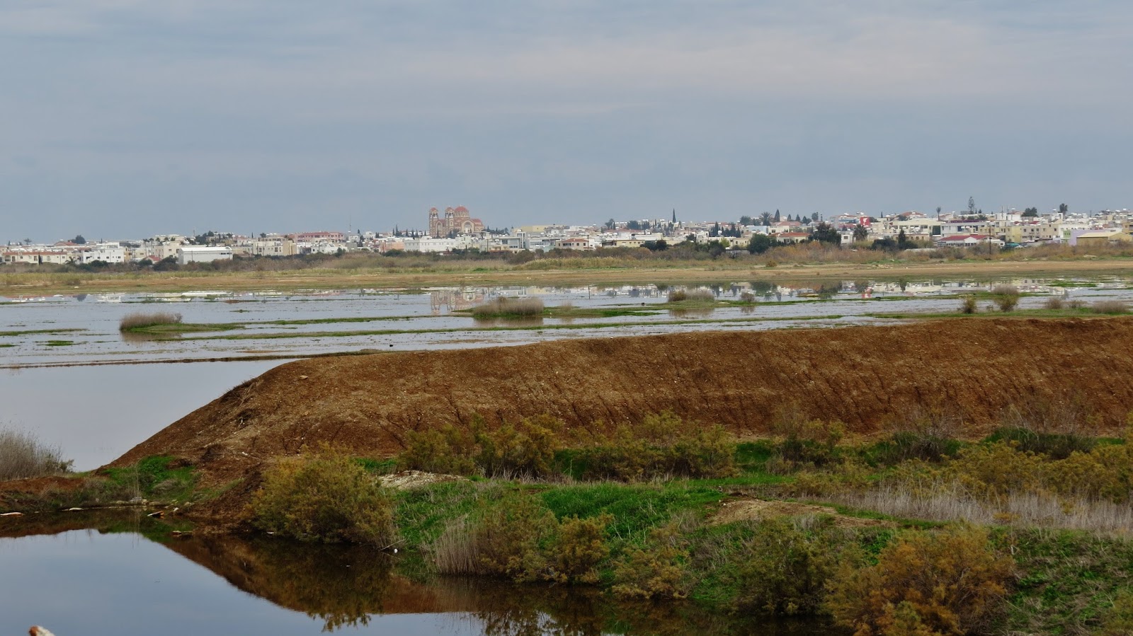
My place, Paralimni, was nothing but a tiny agricultural village during WW2. The name means “by the lake”, as it was built on the shore of a narrow seasonal lake, which was full only during winters. In 1900, canals were created for farming, and the lake became completely dry… thus endemic malaria ceased to exist as well.
During the summer of 1940 (no exact date survived), an Italian pilot landed to the lake’s basin, run out of fuel. The residents help him, gave him gasoline, and he left.
Nevertheless, Cyprus in the 1940’s was a British colony, so after this incident, the British authorities issue a command about building observation posts and obstacles in the lake, constructed by the residents. Also, in the whole area and island, medieval sea posts were re-used, mostly built during the byzantine, crusader, and venetian periods of the island…
For the duration of the war Cyprus became the field for air-combats, mainly between the RAF and Italian air-force, but the island was never under the threat of land invasion.
On August 26, 1940 the fields near Paralimni suffered a bombardment during night, from the Italians, the target was the disruption of harvest…
Apart those events, the main conserns of the civilians back then was their daily lives, and mainly an earthquake on January 20, 1941, which caused a typhus epidemic, mainly from the absence of any humanitarian aid… Another concern were the 21 local volunteers, fighting for the Greek and the British armies in the Balkans and North Africa. All moblilized men from Paralimni survived the war and returned home.
A blackout was imposed every night, and ration cards as well, for the control of the food supplies. Also, many donkeys and mules were sold to the British authorities, who needed them as pack animals…
After the war, the area became a center of Jewish Holocaust survivors, as Cyprus was the last stop before Palestine. The British reopened Karaolos prisoner of war camp, near Paralimni, for containing the Jewish refugees, as their immigration to the British Mandate of Palestine was prohibited. As was natural, the locals interacted with the Jews in a common anti-British spirit, and the local market experienced an upresented rise. The movie Exodus of 1960 (Paul Newman, Eva Marie Saint) was inspired from this event and it was filmed on the original locations.
Cyprus internment camps remained operational until 1949, after the creation of Israel, when the British let the Jewish internees free.
Map of the area
The lake basin as it is today
5 Likes
I was born and continue to live in the Eindhoven area of the Netherlands. While my village saw little to no action, Hell’s Highway of Market Garden was very close. Famous places with heavy fighting like Son (with one of the bridges) and Eindhoven are very near, in fact I work in Eindhoven. I recently bought a small booklet about Market Garden and it was interesting to see photos from back then and compare them how it is now.
In Son, about a 20 minute drive, there is a small museum dedicated to the 101st Airborne that helped liberated this part of the Netherlands as they jumped into the area around son and Eindhoven among other places. Those who have seen Band of Brothers will remember the Market Garden episodes probably. I liked the details they put into Nuenen (on my route to Eindhoven) and Eindhoven, even going so far as recreating the historical center of Nuenen.
I think that was about all what happened here and as far as I can tell my town was spared completely., but I can’t be sure. The neighbouring Mariahout does have a small cemetery with fallen Commonwealth soldiers but I don’t know if they died there directly or in the vicinity of Market Garden (since Veghel, were is also heavy fighting is not far away either). Basically I can say my village had fighting all around it in 15-20 km in every direction but we were in quiet gap.
4 Likes
The city where I was born and live in is called Doetinchem (the Netherlands).
Not much happened in Doetinchem in the second world war, other than there being an NSB (the Dutch counterpart to Nazi’s in Germany) headquarters. In 1944, Doetinchem was bombed in a British air raid because it’s quite close to the German border and the British must’ve believed they were already above German soil. There’s a myth floating around that the British bombed Doetinchem deliberately because they believed there to be a big German laboratory where they researched Nuclear bombs. This of course has never been proven (probably because it’s simply not true).
The town where my grandparents live, and where I spent 1/4th of my year each year since I was born, is called Aszód (Hungary)
It’s a small village, 60 km to the east of Budapest, and therefore, didn’t see any major fighting either. As far as I know, the Soviets just drove through Aszód to get to Budapest without any resistance.
Edit: I just remembered a small detail: of the 1100 jews living in Aszód before 1940, 1100 (so that’s 100%) of them would die in concentration camps. Hungary deported the largest amount of jews of any country in the Second World War.
A question for everyone: would it be a good idea to start a “share family history” thread? Everyone could talk about noteworthy historical events someone in your family took part in, witnessed etc.
3 Likes
I see no reason why one couldn’t be started. I think everyone is civil enough to respect “the other side” and discuss things in a mature way.
2 Likes
I grew up in suburban Boston, so I’ll spare you the same tales you’ve heard before. These days I live on the Gulf Coast of the US in Mobile, AL. We have the dubious honor of being the last place a slave ship landed in the US, in 1860. Because this was only 5 years before slavery ended, the folks freed from slavery were able to set up their own settlement on the edge of town. It created a unique blend of cultures not seen anywhere else in the world. The section became the “Africatown “ neighborhood inside the city eventually. Unfortunately it’s now a slum with almost no connection to its past.
5 Likes
A project of Freie Universität of Berlin
The project “Memories of the Occupation of Greece” preserves the memory of Greek contemporary witnesses of the German occupation of Greece under the Nazis. Their accounts are recorded, researched, and made available on an online platform.
The interviews were conducted, indexed and supplemented with additional source material and made available online.
The collection of video interviews contains life story interviews with 91 contemporary witnesses of the German occupation of Greece under the Nazis (1941-1944).
The project is financed by the Foreign Office of the Federal Republic of Germany, the Stavros Niarchos Foundation, the “Memory, Responsibility and Future” Foundation (EVZ), and Freie Universität Berlin. A cooperation has been established with the National and Kapodistrian University of Athens.
The site is in English, German and Greek
2 Likes
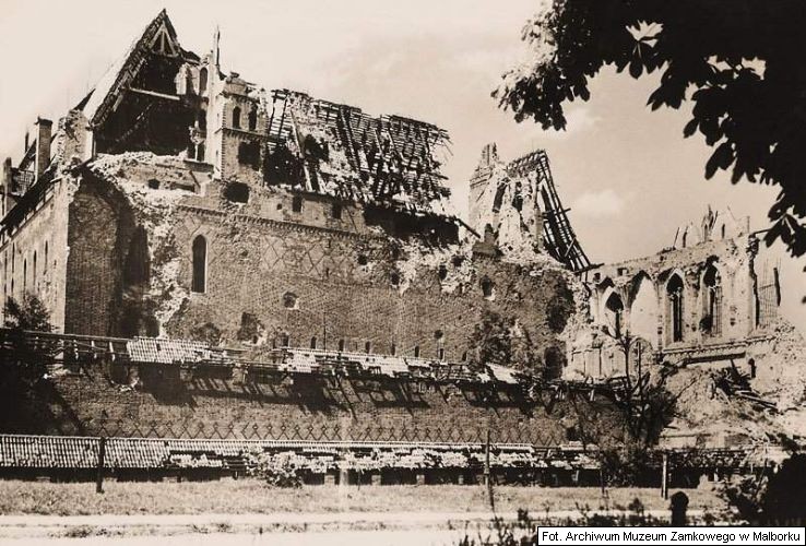
Malbork aka Marienburg.
Famous for Castle but thing or two happened here During WW2
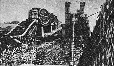
First, There is railway line. From Koenigsburg to Berlin.
1 September , early morning.Before Westerplatte got shot up, train containing troops that were to capture Vistula River Bridges started to move up the track towards Tczew (Dirshau) . Polish custom offices were on the way, first one in Kałdowo (Vogelsang, on the other side of Nogat from Castle), only fired signal rocket, second one in Szymankowo, 10 km up the track, tried derailing and got executed for trying so (About 40 people, first war causalities by some accounts, this happened before 4:34 in the morning) About same time Tczew itself got bombarded by Luftwaffe. Due the delaying action with the train Tczew garrison managed to close bridge gates and at 6:00 blow the bridges themselves.
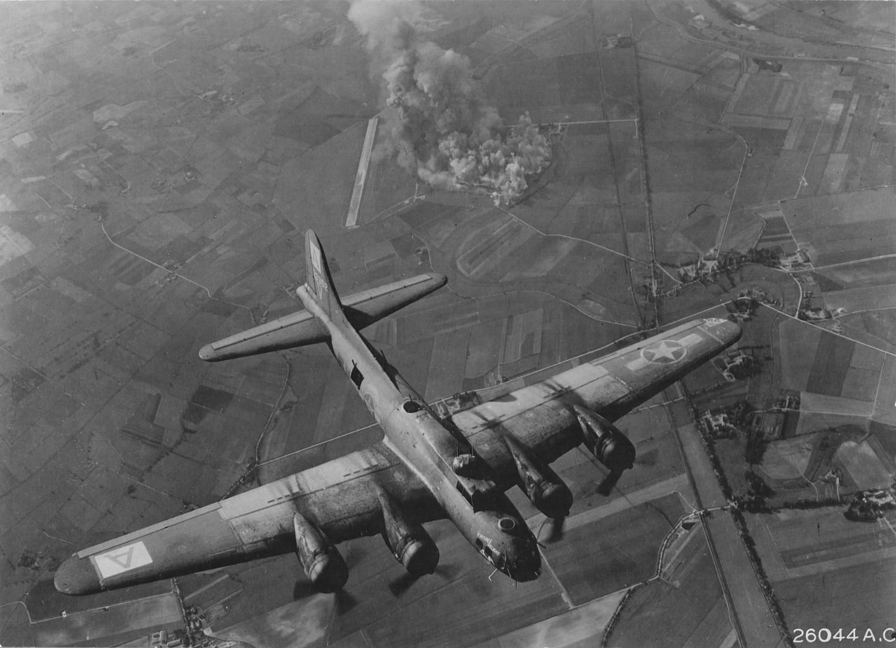
For duration of the War, city itself was site of Focke Wulf factory, staffed in part by POW’s from STALAG XXB that also was in city.
1943 October 9 Focke Wulf factory was target of Allied B-17 raid
http://ww2today.com/9th-october-1943-the-marienburg-focke-wulf-plant-raid
1945 city was besieged from 26 January to 17 March. Castle was turned into fortress of sorts, protecting Nogat Bridges and the railway line to Tczew, staffed by sailors and Hitler Jugend unit. Still they managed to burn first storm attempt (26 January, by the Soviet 161 Tank Brigade)

By March 17 Artillery was called in, castle ruined and German units blew the bridges and falled back
4 Likes
The Soviet Army was still fielding armoured divisions with Lend Lease tanks at this stage of the war? Didn’t know that.
2 Likes
I think they used them pretty much until the end of the war.
2 Likes